
|
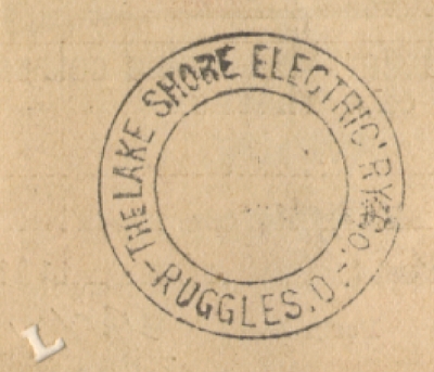
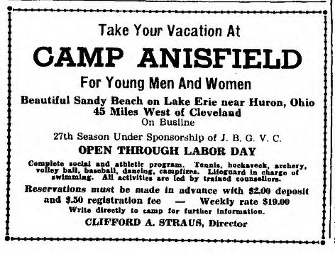
Adjoining Mitiwanga to the west is the community of Ruggles Beach. While these were only two of many summer resorts in this part of Vacationland, they were by far the two most popular and well established in the area. Almon Ruggles came to Ohio from Connecticut in 1805 to survey the "Fire Sufferer's Land" - known simply as The Firelands today. As part of his compensation for this service he was allowed to purchase one square mile (640 acres) of land along Lake Erie at the reduced rate of $1 per acre. The lot he chose stretched from the lake to just south of present- day Darrow Road, east to present Frailey Road, and west past present Hahn Road. Almon brought his family to Ohio in 1810. It is said that while building his first wood frame farm house in 1813 he heard cannon fire in the distance, learning later that it was the battle of Put-in-Bay between American Oliver Perry and the British Royal Navy. By 1825 Ruggles had built a prosperous farm and another farmhouse that would be home to five generations of the Ruggles family. He remained respected and influential in the area his entire life, serving in the Ohio Senate and as a judge. Upon his death in 1840 his land was divided among his heirs, and some (as was the case with Mitiwanga) was sold. Almon's son, Richard, retained the family homestead. He recognized the beauty and potential of the twenty-five acres of wooded land and gently sloping beach and opened it to the public in 1868 under the name Ruggles Grove. Locals from surrounding communities came to the grove for picnics and swimming as well as meetings and outings for farmers groups and churches. In June of 1891 Almon's grandson, Charles, expanded the picnic grove into a summer vacation resort. A farmhouse on the south side of Lake Road was converted to a summer hotel and about a dozen cottages were built north of the road. A great deal more space was available to rent for camping in tents. A well equipped bath house and boat house were also built on the beach and the name was officially changed from Ruggles Grove to Ruggles Beach (although locals continued to use the name "grove" for many decades.) Charles probably built the first dance pavillion around this time as well. It was destroyed by a fire and a second pavillion was built in 1907. This was the location of LSE stop 150, on the double ended passing siding between Mitiwanga and Ruggles Beach. The dance hall was very popular with visitors to the resorts and locals from surrounding towns who could easily travel there on Lake Shore Electric cars. It also served as a meeting hall for organizations who held their gatherings at Ruggles Beach. During the 1930's dancing was held every night through June, July, and August. Music was provided by various live bands, both small local groups and traveling bands of wide reknown which made the "summer circuit" around Lake Erie playing at the many resorts and dance halls. As times changed roller skating became more popular than dancing. In 1937 a group of Lorain investors purchased the old dance hall and operated it exclusively as a skating rink. It continued in this incarnation until July 4, 1959 when it was completely destroyed by a fire. A new dance club named The Note was built in its place but never recaptured the popularity the old Ruggles dance hall had known in the early century. Today the building is used for storage for the nearby condominiums. At least two hotels served guests at Ruggles Beach. Besides the large Ruggles Hotel, sometimes known as "the farm," the smaller Ruggles Beach Hotel was located on the north side of Lake Road between the dance hall and cottages. Although slightly damaged by the dance hall fire in 1959 this hotel still stands on Park View Ave. and is still operated as a hotel by a Ruggles family descendent. The larger hotel was on the south side of the road and railway tracks and included tennis courts. As the days of the bustling lake resorts came to a close in the 1950's the hotel was purchased by Lloyd Moats, proprietor of the Moats Modern Camp and Moats Acres cabin rentals. In 1955 the hotel was converted to a xx unit apartment building. Sadly, on March 25, 1957, the building was completely destroyed by a fire. All residents escaped without injury. The site is now occupied by the Vacationland mobile home park. Cranberry Creek met Lake Erie in a small marshy bay at Ruggles Beach and was an ideal spot for resort guests to enjoy rowboats and canoes. Today the Cranberry Creek Marina occupies the mouth of the creek which has been dredged and widened for small pleasure boats. Stone abutments of the LSE bridge over the creek can still be seen on the south side of Lake Road. Lake Road Old & New Known variously as Lake Road, the Lake Shore Road, or Cleveland Sandusky Road, this east-west highway connected the cities of Cleveland, Lorain, Vermilion and Sandusky, and was one of the most important roads for northern Ohio towns from pioneer days through the interurban era. Originally the road evolved from Native American trails along the shore of Lake Erie. Early 19th century pioneers followed these trails as they settled west. Increased use by wagons and stagecoaches furthered the development from trails into a bona-fide road by the end of the century. But aside from short sections within the larger cities, the road was unpaved and travel by foot, horse-drawn wagon, or one of the very few early automobiles, was slow and tedious. The Lake Shore Electric was created to connect Cleveland and Toledo and serve the multitude of small towns along the Lake Road between them. Not surprisingly the LSE was built alongside this and a few other major roads which crossed northern Ohio, offering fast, reliable travel immediately parallel to the established routes. Automobile use and road improvements increased in the 1920's and the precursor of our modern highway system was being created. In 1924 the Lake Road between Toledo and Cleveland was designated Ohio State Route 2, and in 1931 it also became part of US Route 6. The road followed the shore of Lake Erie closely, almost always within sight of the water and in some places skirting very near the lapping waves. These waves, however, proved destructive over time. This erosion is a constant function of the lake and continues to this day, effecting some locations more severely than others. The years 1929 and 1930 were particularly destructive for Erie County. Unusually low water levels followed by a fierce nor'easter caused severe erosion to the shore near Ruggles Beach. By then the road built near the beautiful views and breathtaking sunsets of the lake was in danger of literally falling into the water. Between 1931 and 1932 Lake Road between Ruggles Beach and Old Woman Creek was relocated several hundred feet south. The LSE tracks had been built along the south side of the original road, and while the state of Ohio could afford the relocation project the LSE was very near bankruptcy at the time. Despite the threat to its right-of-way the railway had no choice but to struggle on in the hope that its financial situation would improve before Lake Erie claimed its rails. With the new road taking a more direct route and the LSE veering north to follow the old road a hazardous crossing was created at stop 151, just west of Cranberry Creek. By this time, however, safety concerns about many railroad crossings in Ohio had resulted in requirements for electric flashers at the busiest of these, and no accidents are known to have occurred here. A stub of the old Lake Road still exists for access to a few homes but much of the road has since crumbled into the lake. Camp Anisfield John Anisfield was born near Vienna, Austria in 1860, and emmigrated to the United States in 1876. For six years he worked for his uncle's cloak manufacturing business in Cleveland before establishing his own prosperous cloak and suit company. In 1915 his civic and philanthropic interests led him to donate seven acres of land outside Huron for a jewish summer camp. The camp, named in his honor, was first operated by the Jewish Girls Vocation Club, later becoming a mixed camp under the Jewish Boys and Girls Vacation Club. Camp activities included swimming at the beach, tennis, boating, baseball, archery, horseback riding, volleyball, music and drama. Young Jewish men and women from Cleveland could board Lake Shore Electric cars (and later Lake Shore Coach Co. buses) at the Public Square station and ride directly to the camp at stop 155. The camp remained active into the 1940's and has since become the Colonial Villa mobile home park. Some of the original cottages along the west edge of the camp are still in use by the new tennants. Otto's Beach Stop 156 was at the intersection of Lake Road and Ceylon Road (now State Route 61) where the home of George Neiding stood. The house still stands but very little remains of the old road, now crumbling and overgrown. Nearby stop 156½ was the site of Otto's Beach, created by George Otto (see Ceylon Junction page for more.) The exact location of this beach or what amenaties and attractions it may have offered (if any) are something of a mystery today. The beach itself was long ago washed away by Lake Erie and no photographs or documentation are known to exist. The Otto family still owns the property but are quite private about their history. |

the Ruggles Beach dance hall. (Dennis Lamont) |
was purchased at Ruggles Beach. (Dennis Lamont) |
|

the Ruggles Hotel. Note the LSE poles. (Ernst Neibergall photo) |
|

dance pavillion on Lake Road. (Drew Penfield) |
|

Ruggles Beach dance pavillion. (Ernst Niebergall photo) |
|

stands as a residence today. (Ernst Niebergall photo) |
|

around 1890. (Ernst Niebergall photo) |
|

relaxing in the shade on a summer day. (Ernst Niebergall photo) |
|

tracks visible at bottom of photo. (Ernst Neibergall photo) |
|

Ruggles Beach. (Ernst Neibergall photo) |
|

(unknown collection) |

at Ruggles Beach. (Ernst Neibergall photo) |

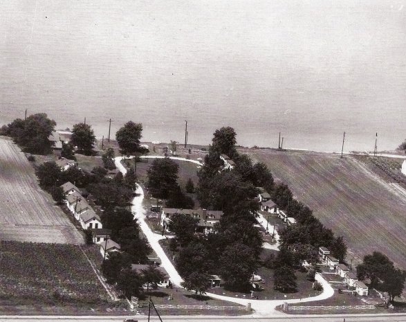
Ruggles hotels, the dance hall, and the Lake Shore Electric tracks at the far right. (Pam Seymour) |
|

Lake Erie in a marshy bay. (Ernst Neibergall photo) |

(Vermilion Views) |

at the mouth of the creek. (cranberrycreekmarina.com) |

Road and old road's concrete railing. (Drew Penfield photo) |

Electric is visible at right. (Ernst Neibergall photo) |

the road has since fallen into the lake. (Ernst Neibergall photo) |

follow Old Lake Road to the right. (Dennis Lamont) |

new Lake Road at left. (Dennis Lamont) |

(Drew Penfield photo) |

poles at left mark LSE right-of-way. (Dennis Lamont photo) |
(Berlin Heights Historical Society) |

(Dennis Lamont) |
(Ohio Jewish Chronicle) |

(Berlin Heights Historical Society) |
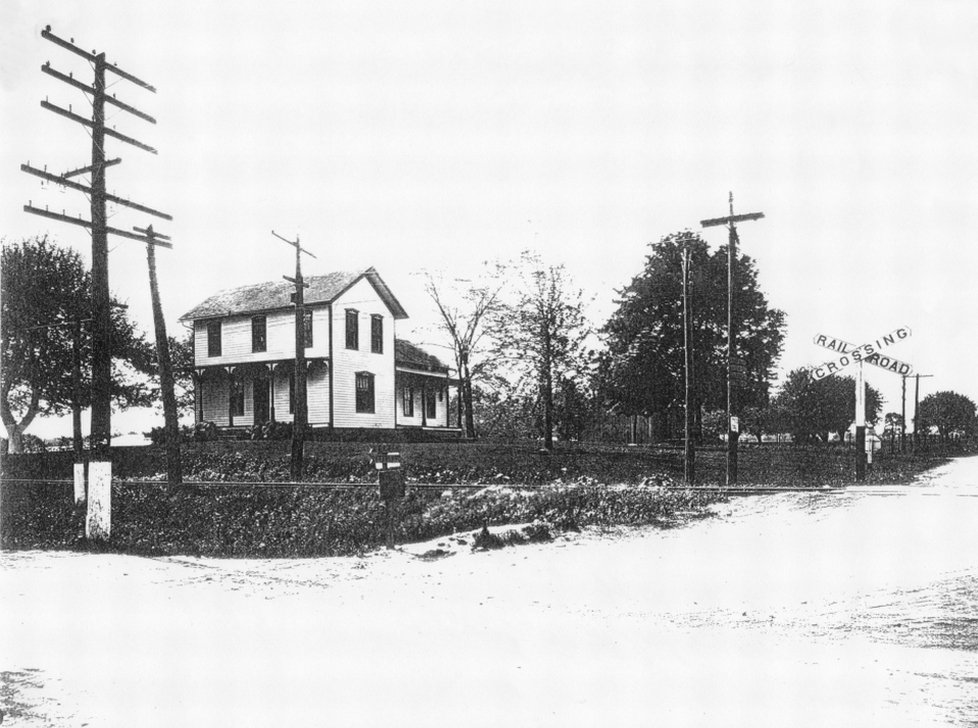
Road and Ceylon Road. (Ernst Neibergall photo) |

(Ernst Neibergall photo) |

(Ernst Neibergall photo) |

Road, April 2011. (Drew Penfield photo) |
|
|
|