
|
The original route followed Detroit Ave., over seven miles of track in the center of a busy major street. In June of 1903 the Lake Shore began using the new Clifton Blvd. route to the north. This slightly longer route was actually faster as the tracks were laid in the tree lawns on either side of the residential street, thus avoiding traffic. The Lake Shore was prohibited from making local stops along Cleveland Railway tracks between Public Square (stop A) and Rocky River (stop B.) Passengers boarded at either end and simply passed through Lakewood. However, there were freight operations within the city. Harry Christiansen points out Viking Court, near the intersection of Lake Ave. and Clifton Blvd., as "an old city trolley loop where the Lake Shore unloaded freight cars in the early days." According to Dennis Lamont there was no depot or terminal here and it was most likely just a stop for unloading less-than-carload packages "which they did at many places before they really got into the freight business." Another location was near the Cleveland Railway car barn at W. 117th and Madison Ave. This freight "house," like others, was little more than a wooden shed where outgoing packages were collected before being loaded onto LSE cars. The shed seen in the photo below may have been the original built by the Lake Shore in 1927 and later moved when the Cleveland Railway changed the track arrangement at this location, but no hard proof has been found. From downtown Cleveland the Lake Shore route followed Detroit Ave. to Lake Ave., where it veered to the north. After passing under the New York Central Railroad tracks the route turned west for a short stretch on Baltic Road (now part of Clifton) and then onto Clifton Blvd. The turn from Lake Ave. to Clifton Blvd. was the point at which the two sets of rails left the middle of the city street and ran through the tree lawns on either side of Clifton Blvd. Westbound cars used the north track, eastbound cars used the south track. It is interesting to imagine the big interurbans travelling through the lawns of a residential neighborhood, or early automobile owners having to cross railway tracks at the end of their driveways, but this is exactly how the line was built. At the west end of the city Clifton Blvd. turned south at what is now called West Clifton Blvd. After passing under the Nickel Plate Railroad tracks the interurban route turned west and followed Sloane Ave. toward Rocky River. This location is notable for a derailment that occurred in 1937 (see photos). On April 14th #179, eastbound for Cleveland, jumped from the tracks as it made the turn from Sloane Ave. to Clifton. It struck an iron pole at the side of the road, damaging the car and injuring four passengers. Today you can still drive the route through Lakewood, but nothing remains of the electric railways. Clifton Blvd was widened from four lanes to seven, and the tree lawns where the railway tracks were laid have since been paved over to create the new lanes. |
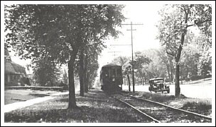
of Clifton Blvd. (Harry Christiansen) |

"Cleveland" destination sign is an error. (W.A. McCaleb) |
|
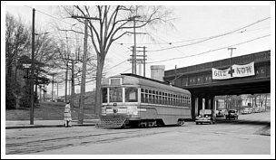
tracks on Lake Ave. near Clifton. (Dennis Lamont) |
|

Viking Ct. siding is visible at the bottom. (Dennis Lamont) |
|
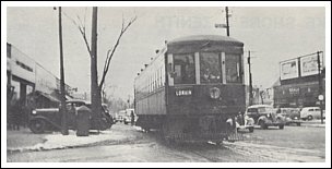
in the winter of 1936. (Harry Christiansen photo) |
|
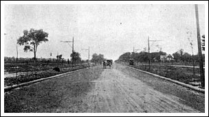
(Cleveland State University Library) |
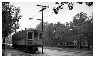
(Cleveland State University Library) |

Railway streetcars. (Cleveland State University Library) |
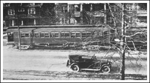
(Cleveland State University Library) |
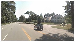
covers the railway's path (Google Earth) |

its way to the Eagle Ave. freight house. (Thomas Patton) |

(Cleveland State University Library) |
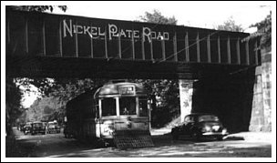
Railroad on West Clifton. (Cleveland State University Library) |
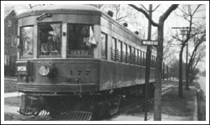
(Dennis Lamont) |
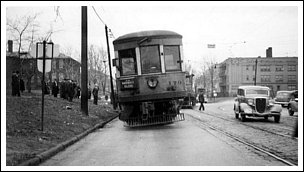
the rails. (Cleveland State University Library) |
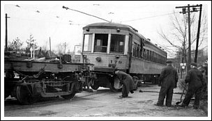
(Cleveland State University Library) |
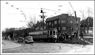
(Cleveland State University Library) |
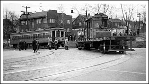
(Cleveland State University Library) |
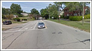
Sloane Ave. at left. (Google Maps) |
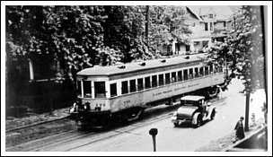
day of operation. (Cleveland State University Library) |
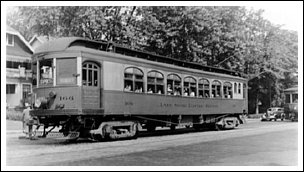
Lorain local. (Cleveland State University Library) |
|
|
|